Aerial Surveyors
Are you struggling to get a comprehensive view of your project site? Our expert aerial surveyors can provide the precise and detailed data you need to make informed decisions for your project.
Utilising modern technology that has revolutionised the surveying industry, such as drones, our surveyors can quickly capture high-resolution images and data of a land area from above to create accurate maps, 3D models, and more.
With offices in Mangawhai and Hibiscus Coast, our aerial land surveying experts are familiar with the local terrain and ready to assist your project. Contact us today!
Our Aerial Land Surveying Services
Aerial surveying is a versatile type of land surveying tailored to meet the needs of our clients. State-of-the-art technology enables our experts to provide accurate, efficient, and cost-effective solutions for projects across several industries. Our land surveyors in Auckland can use drones to assist with:

Data Collection

Site Analysis & Planning

Project Progress Monitoring
Your Trusted Aerial Surveying Company
Horizon’s team of aerial surveyors delivers unparalleled accuracy, efficiency, and value. Our experienced professionals use industry-leading technology to capture high-quality data to aid you in making informed decisions.
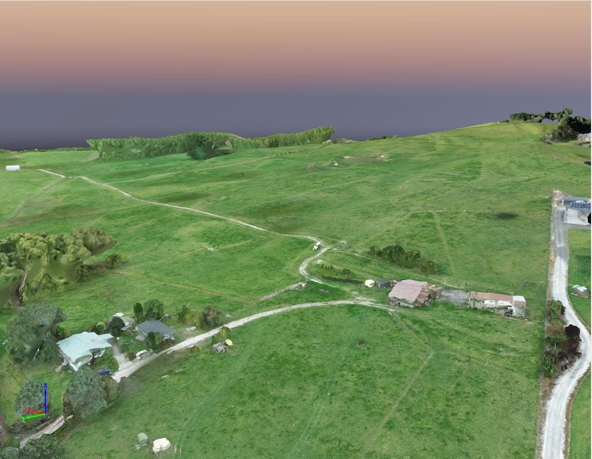
Our previous Whangaripo Valley Road project demonstrated that aerial land surveying offers a cost-effective and efficient solution for large-scale land assessments. Using drones to capture aerial imagery of the site and create detailed 3D models, we could provide the client with a comprehensive understanding of their property, even in challenging terrain.
You can count on us for fast turnaround times, comprehensive coverage, and cost-effective solutions tailored to your project’s requirements.
Frequently Asked Questions
What are the benefits of aerial surveying compared to other surveying methods?
Aerial land surveying offers a range of advantages that make it a valuable tool for many applications. Compared to traditional ground-based methods, aerial surveying:
- It is more efficient: It covers large areas quickly, saving time and resources.
- It is safer: Allows for inspecting hazardous or inaccessible locations without putting personnel at risk.
- Provides detailed data: High-resolution imagery is captured to create accurate 3D models, providing a comprehensive understanding of the site.
- It is cost-effective: In many cases, aerial surveying can be more cost-effective than ground-based methods, especially for large or complex projects.
- Offers faster results: Data collection and processing are typically faster with aerial surveying.
How accurate are aerial surveys?
The accuracy of aerial surveys depends on several factors, including sensor quality and ground control points. Advances in GPS, camera, and LiDAR technology have significantly improved accuracy in recent years, delivering much more accurate results.
In situations requiring further precision, aerial surveys can be combined with ground measurements, such as those from a smaller topographical survey, for maximum accuracy.
Are there any restrictions on aerial land surveying?
Aerial surveying has a few restrictions to consider, primarily with New Zealand’s drone and aviation regulations. It’s vital to adhere to height limits (120m max), visual line of sight requirements, and restrictions on flying near airports. Compliance with general aviation rules and potential permits is also sometimes required.
Our aerial surveyors must comply with local regulations and industry standards. Our experts must also consider weather conditions, respect privacy rights, adhere to accuracy standards, and obtain necessary permissions to access certain areas.
Work with Horizon’s Expert Aerial Surveyors
Ready to take your project to new heights? Contact our team today to learn more about how our aerial surveying company can help. Beyond delivering accurate aerial surveys, our topographical and cadastral surveyors are also committed to providing clients with efficient, precise ground surveying.
Contact our experts today for exceptional results that exceed expectations. Fill out the form below or give us a good old fashioned phone call on 09 869 4585.
Red Beach
- 170 Hibiscus Coast Highway, Red Beach, 0932
- horizon@hsld.nz
- 027 244 7125
- 09 869 4585
Mangawhai
- 4 Wood Street Mangawhai Heads, 0505
- horizon@hsld.nz
- 09 431 4568
Already have an excellent idea...

")