Landscape and Visual Assessment of Baldrock Road, Kaiwaka
What is a Landscape and Visual Assessment?
A Landscape and Visual Assessment is an assessment prepared by a qualified Landscape Architect, which is required to follow the NZILA industry recognised Landscape Assessment Guidelines – Te Tangi a te Manu. The purpose of these assessments is to assist the decision-making process for resource consent applications, ensuring the management and improvement of landscape values for any proposed development of a site.
Image 1: Landscape Assessment Guidelines – Te Tangi a te Manu

How does this assessment form part of a Resource Consent Application?
The Landscape Architects role is to identify the values of the landscape (generally the subject site and surrounding context), assess the effects of the proposed subdivision or development on such values, and provide design measures to maintain or improve these values where necessary. A key component of these assessments is to determine where the site and future development is visible from, identify who the viewing audience is, and evaluate the magnitude of landscape and visual effects in relation to the context of the site.
Design measures often include proposing planting to visually screen and soften buildings which would result from the proposed subdivision once consented, or proposing building and landscape design guidelines for future buildings to manage visual effects, often including restrictions on building colours or heights. These design measures are then offered as consent notice conditions, registered to future titles to ensure that the subdivision or development once complete continues to maintain the landscape values as determined by the Landscape and Visual Assessment.
A Landscape and Visual Assessment is often required for Resource Consent Applications in Kaipara District, and often necessary for subdivisions and development proposed in the Rural Zone. This assessment is prepared and submitted with the subdivision or land use Resource Consent Application to assist the decision-making process, and to provide confidence that the subdivision or development will maintain the landscape values, character, amenity of the landscape, manage adverse visual effects, and meet the objectives and policies of the District Plan.
Project Focus – Baldrock Road, Kaiwaka
A recent subdivision where a Landscape and Visual Assessment was required was on Baldrock Road, Kaiwaka. The proposed subdivision created seven lots, under the Environmental Benefit Provision of the Kaipara District Plan. Given the location and contour of the site, a Landscape and Visual Assessment was necessary to determine the effects of the proposed subdivision, and assess the consistency of the proposal with the surrounding development pattern.
Image 2: Viewpoint Locations Assessed
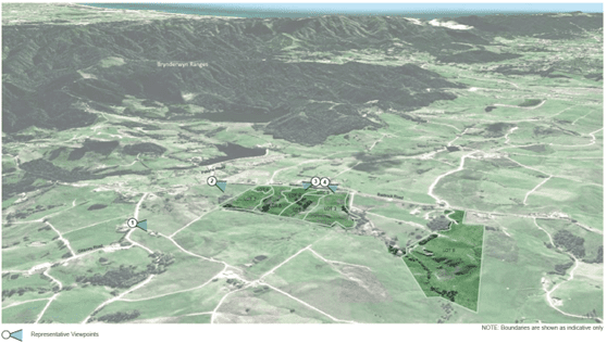
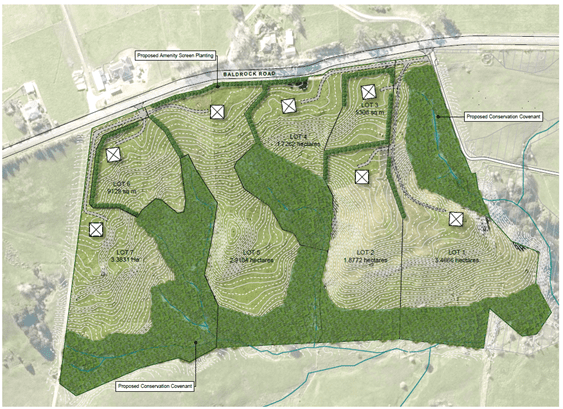
Image 3: Concept Plan
The purpose of the assessment was to determine the appropriateness of the subdivision proposal in its context by:
- Describing and analysing the site in its contextual landscape
- Assessing and evaluating the effects of the proposed subdivision on visual amenity
- Addressing relevant policy matters
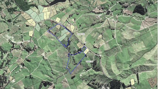
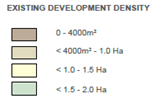
Image 4: Surrounding Development Pattern
As a summary the assessment included the following:
- Site analysis and review of the proposed subdivision plans.
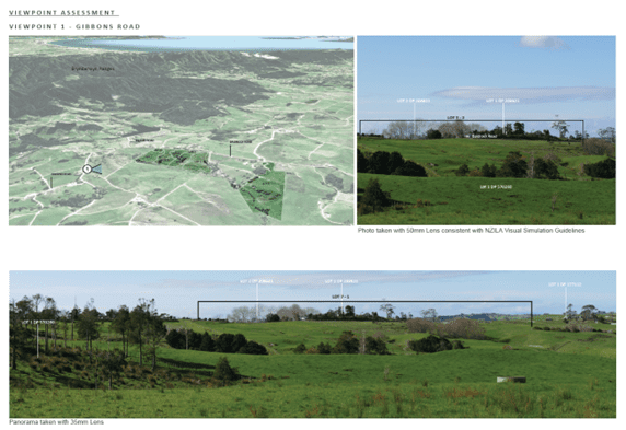
- Determining key viewpoint locations where the site contributes to the landscape, including an analysis of the site’s attributes, characteristics and values, and how they contribute to the visual amenity.
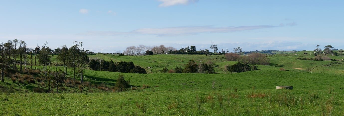
- Assess the visual effects of the proposed development from each of the identified viewpoints, taking relevant photographs.
- Suggesting mitigation measures – this included planting throughout the site, particularly along roadside boundaries to screen and soften future buildings, and provide vegetated backdrops. A plant list was created selecting species with suitable heights, densities, growth rates, and tolerance to the site conditions.
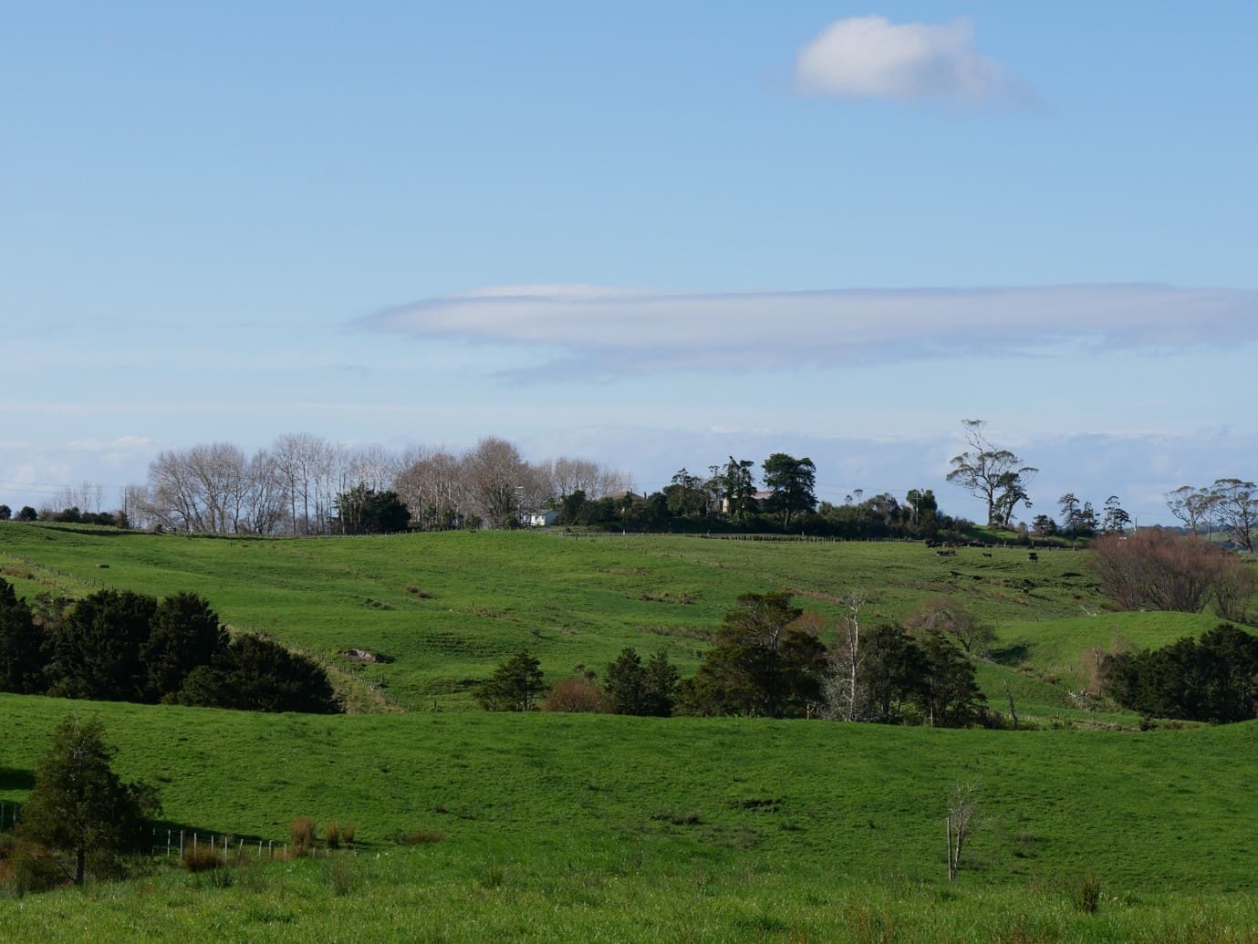
Image 5: Viewpoint 1 Viewpoint Photography
A number of building and landscape controls were also necessary including limiting fencing types to post and rail / batten and wire, ensuring proposed building platforms avoid ridgelines, limiting the colour palette of buildings to neutral colours where painted, or otherwise utilising a natural timber, stone, or brick as the main building material. These mitigation measures were proposed to ensure that future development on site compliments the landscape and surrounding development patterns, and retains the landscape values identified.
Image 6: Site Photos
This project was completed by our Landscape Architect Caitlin Wallace. If you would like to find out more about how a landscape architect could help you with a potential development project you can contact Caitlin at caitlin@hsld.nz or call (09) 431 4568. To find out more about Landscape Architecture click here.