
Staff Profile Richard Bromley - Survey Manager
Richard Bromley
MS+SNZ, B.Surv., B.Sc, Registered Professional Surveyor, Licensed Cadastral Surveyor
In 2022 we welcome Richard Bromley to the team as our Survey Manager. Richard is a highly experienced Licensed Cadastral surveyor and holds a Bachelor of Surveying from Otago University.
Richard has over 40 years experiencing working in the wider Auckland region and further a field. In his spare time Richard can be found diving into a good book and has a keen interest in historical accounts of pioneering surveyors of New Zealand and collecting historical surveying gear.
Barrack Road, Mt Wellington
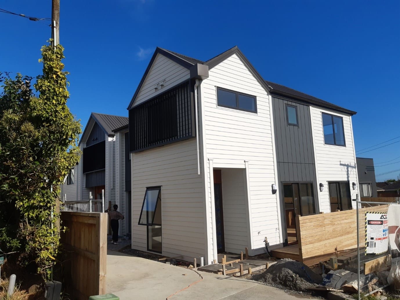
The original site had one existing dwelling on a 675 m2 Title and was to be developed with four new dwellings.
Topographical Survey:
We completed a topographical survey for the client to facilitate the design of the four new dwellings.
Set-out Surveys:
We then set-out the stormwater & wastewater drainage lines along with building foundations for construction and provided set-out certificates for the client and Council.
As-Builts & Certification
The Land Use & Building Consents required “Height in Relation to Boundary” (HIRB) certification by a Licensed Cadastral Surveyor (LCS). Following removal of the scaffolding we surveyed the HIRB using conventional Total Station survey equipment and provided the required LCS certification.
Land Transfer Survey
"Once we obtained suitable access to the site and fencing was largely completed, we carried out the Land Transfer Survey to peg the Boundaries of each Lot and the Legal Access (Right of Way).
Field work was carried out by one of our Survey Technicians with oversight and certification by one of our Licensed Cadastral surveyors.
As is currently common in Auckland the dwellings are close together leading to internal boundaries on the face of walls, and eaves overhanging boundaries, for which Easements were created for Rights to overhang and maintain.
All services, including electricity, telecommunications & water supply were provided beneath the driveway and covered by easements." - Richard Bromley Survey Manager
To find out more information on our Surveying services you can view it here.
Already have an excellent idea...

")